
Slieve Carn [Cuillalea] [Sliabh Chairn]
Good walks are even better shared.
Overview
Slieve Carn [Cuillalea] [Sliabh Chairn]
Nestled in the scenic Sperrin Mountains of Northern Ireland, Slieve Carn, standing at 586 meters, is a delightful Marilyn that offers a mix of challenge and beauty. Perfect for a day hike, it's an ideal spot for those keen to explore the natural wonders that the region has to offer.
Geology
Slieve Carn's geology boasts a combination of sandstone and mudstone, a result of the ancient seabed deposits that shaped this region. The unique geological setting offers glimpses of a time long past when the landscape looked vastly different. It's a fascinating tale written in stone, just waiting for an eager geologist or curious hiker to read.
Routes
Glenshane Pass Route
Starting from the Glenshane Pass, this moderate trail winds its way up through vibrant heather and lush greens, encouraging hikers to soak up the sights along the way. It's approximately 5.2 km long and takes about 2 hours to complete, perfect for an afternoon adventure.
Summit Features
At the pinnacle, you’ll encounter a charming cairn, which serves as both a photo op and a reminder of the mountain’s cultural importance. Don’t forget to pack your camera — the views are worth capturing!
Terrain Type
Expect a delightful mix of grassy slopes and rocky outcrops interspersed with the occasional bog. Every step presents an opportunity for both beauty and a wee surprise in the form of hidden puddles!
Views
From the summit, the panoramic views are absolutely breathtaking. On a clear day, feast your eyes on the sprawling landscape which includes the largest lake in the British Isles, Lough Neagh. The best time to enjoy these vistas is usually late spring or early autumn when the light creates a painter’s palette across the hills.
Hazards
As serene as it is, don’t be fooled; the weather can turn on a sixpence, so keep an eye on the sky. The terrain’s boggy spots can make for slippery conditions — remember to check your boots for any unwelcome mud before entering your car!
Access
The nearest parking can be found at the Glenshane Pass, offering a straightforward start to your hike. While public transport options are limited, the charming village of Draperstown is just a short drive away, providing all necessary amenities — including a cuppa!
Facilities
Draperstown boasts a handful of lovely cafes and shops where you can fuel up before or after your trek. It’s also home to some public toilets for those essential pit stops.
History
The name 'Sliabh Chairn' aptly reflects its cultural heritage, translating to 'mountain of the cairn'. This region whispers stories of ancient tribes, and its historical significance adds a layer of intrigue to your journey.
In conclusion, Slieve Carn [Cuillalea] is more than just a peak – it's a tale waiting to be lived, a landscape waiting to be explored, and perhaps the perfect spot to plan your next outing. So lace up those boots and set forth for an adventure that awaits just around the bend!
Explore routes near Slieve Carn [Cuillalea] [Sliabh Chairn]
Public walks starting within 80 km of this hill. Nearby does not mean a route reaches the summit; check its map and access before setting out.
No public routes are currently listed within 80 km of Slieve Carn [Cuillalea] [Sliabh Chairn] on Walkmates. This does not mean there are no paths here. Explore the map and check local access information before planning a walk.
Route planning notes
These notes describe possible approaches, not verified navigable routes or permission to cross land. Check current paths, local access rules and conditions before setting out.
Glenshane Pass Route
Starting from the Glenshane Pass, this route offers a scenic ascent through rolling hills and heather, leading to the summit of Slieve Carn.
Make a day of it, together
Find someone to share the walk with, or organise a day out along a route you like.
Hill facts and local notes
Classifications
Elevation
262m
860 ft
Prominence
198m
Coordinates
53.8378, -9.0686
M297881
OS Map
31
At the Summit
The summit features a prominent cairn, offering a perfect spot for a picture or a well-deserved snack. On a clear day, you might feel like you can see forever—at least until the next mountain gets in the way!
Terrain & Geology
Slieve Carn is primarily composed of sandstone and mudstone formations, typical of the Sperrin Mountains, which were formed from ancient river and sea deposits over millions of years. The area's varied geological history is a testament to the evolving landscapes shaped by glaciation and erosion.
Views & Scenery
From the summit, you can enjoy views of the Sperrin Mountains, Lough Neagh, and the surrounding countryside. The landscape is an ever-changing tapestry of greens and browns, with the occasional flash of water from nearby lakes.
History & Heritage
Name Origin
The name 'Sliabh Chairn' translates from Irish to 'mountain of the cairn', reflecting its summit feature and possibly hinting at ancient burial or ceremonial significance.
Historical Significance
The area has historical connections to ancient tribes and might even be linked to folklore exploring the relationship between earth and the heavens.
Getting There & Facilities
Check current local access restrictions, parking rules and transport timetables before travelling. These notes do not confirm public access to the summit.
Parking
Parking is available at the Glenshane Pass car park, conveniently situated for access to the route. The parking area is generally safe but check for any specific signs regarding overnight stays.
Public Transport
There is limited public transport to the Glenshane Pass, so it's advisable to travel by car. Local buses might be available from nearby towns, but their frequency can vary.
Nearby Facilities
Facilities in Draperstown include cafes, a shop, and public toilets. The Glenshane Pass itself has picnic areas, but facilities are sparse on the mountain.
Safety Information
Known Hazards
- Beware of changing weather conditions. The terrain can be boggy, and some parts may be slippery, especially after rain.
General Safety Tips
- Check weather conditions before setting out
- Carry appropriate clothing and equipment
- Let someone know your planned route
- Take a map, compass, and GPS device
- Carry emergency supplies: food, water, first aid kit, torch
Hills
Some common questions about the hills answered
Are there group walks up Slieve Carn [Cuillalea] [Sliabh Chairn]?
Many walkers use Walkmates to join or organise walks with others. You can check for group walks around Slieve Carn [Cuillalea] [Sliabh Chairn] through the maps
Are there other walkers around Slieve Carn [Cuillalea] [Sliabh Chairn]?
Activity varies by location and time, but Walkmates lets you see whether others have shared walks or shown interest in this area. Find other people through the walking friends search walking friends for Slieve Carn [Cuillalea] [Sliabh Chairn] search or of course create your own walk for Slieve Carn [Cuillalea] [Sliabh Chairn]
Can I organise a walk to Slieve Carn [Cuillalea] [Sliabh Chairn]?
Yes. If there aren’t any walks listed already, you can create a walk and make it available for others to join.
If you're signed up to Walkmates, you can create a walk to Slieve Carn [Cuillalea] [Sliabh Chairn].
How do I find a walk up this hill?
There are often multiple ways to walk this hill, depending on experience and route preference. Walkmates helps you explore walks and routes that others have shared.
Can I suggest a new route up Slieve Carn [Cuillalea] [Sliabh Chairn]?
Yes. You can suggest or create routes to share with others. Walkmates focuses on the social side of walking, so routes are used to help people organise walks and explore areas together, rather than as detailed navigation tools or route libraries.
Other uses really appreciate knowledgeable walkers sharing their routes. Share your favourite route to Slieve Carn [Cuillalea] [Sliabh Chairn] here
The is an error or something incorrect about this hill. How do I let you know?
We always strive to keep the information on Walkmates as accurate as possible. If you find an error, please let us know through the contact form and we'll aim to correct it as quickly as possible
Community Discussion
Comments
Location
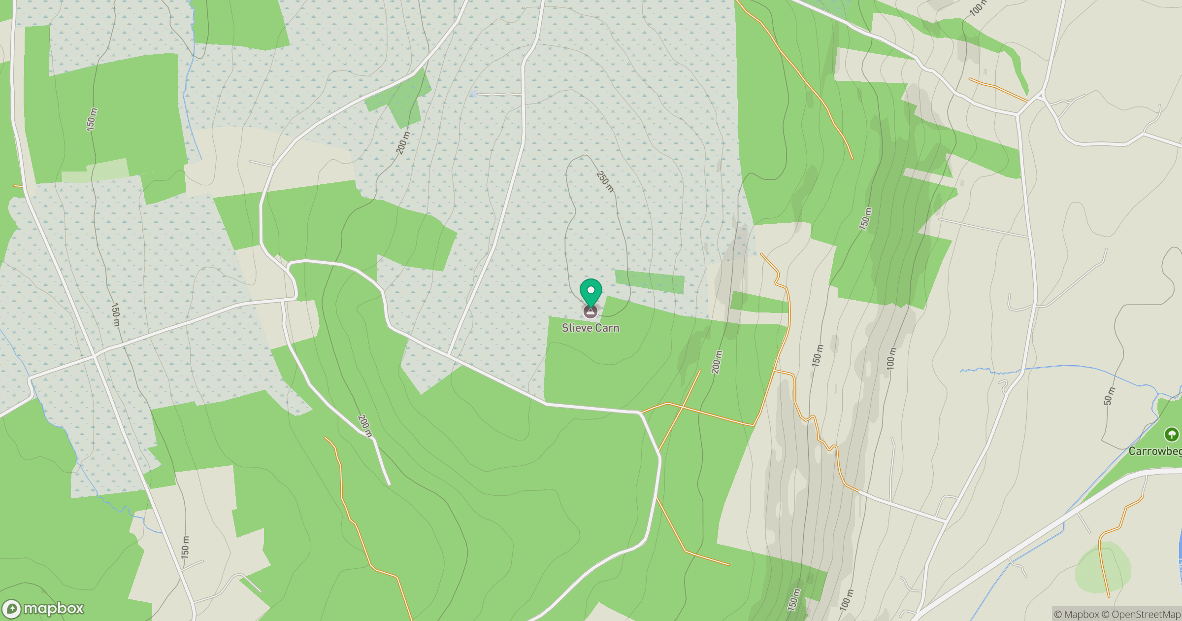
Grid reference: M297881
View on OpenStreetMapOpens a map in a new tab, centred on the hill.
Hills within 30 km
Straight-line distance, not a walking route or confirmation of access.
Knockaglana
154m
Farbreiga [Fear Breige]
395m
Knocknasliggaun [Knockasliggaun]
417m
Crucknaree
297m
Knock Hill
213m
No comments yet. Be the first.